Thursday, September 27, 2012

Climate and Weather

Types of Weather
People commonly discuss weather as a topic while making small talk. Our day-to-day experiences are affected by weather. Weather has had an impact on history and has an impact on life today. Weather changes as a result of differing causes. Atmospheric currents, ocean currents, seasonal variation, location, and possibly even human activities, all have an impact on the weather. How is weather different from climate? Climate is the overall trend of weather patterns, over time, in a given region; whereas weather is the current atmospheric status in a given region. Or in other words, weather is what is happening now and climate is better defined as what happens throughout the year.


Climate ranges from hot to cold and from dry to wet depending upon your location on Earth. Climate trends stay relatively predictable. For example, in the Central San Joaquin Valley we experience hot dry summers, yet our winters are typically characterized with cold, wet, and most often foggy weather. Climate zones are found all over the Earth. Climate zones, however, do not always indicate extreme weather patterns.

Extreme weather happens on Earth everyday. Tornadoes commonly occur over the Midwestern United States; whereas Tropical Cyclones threaten the Eastern United States annually. Southeast Asia typically struggles with extreme tropical weather patterns, yet East Central Africa is currently experiencing severe drought conditions. Below are some examples of extreme weather and their causes.

Tornadoes are caused by a mixture of warm moist air and cool dry air. These types of air masses collide and create supercell thunderstorms. These powerful weather systems are the fuel which gives tornadoes their destructive power. 95% of the tornadoes on Earth happen here in the United States. The cool dry air sweeping down from the Canadian Rockies combines with the warm moist air from the Gulf of Mexico causing extreme weather patterns every year over the United States.


Are we at risk for a Tornado?


Tropical Cyclones, most often called Hurricanes, form all across the mid latitudes over the oceans. Warm ocean currents give strength to tropical atmospheric depressions giving birth to rotating storms up to 700 miles wide. These storms cause billions of dollars in damage every year across the globe. Hurricane Katrina destroyed much of New Orleans and more recently, Super Storm Sandy, a combination of a tropical cyclone and a nor'easter, wreaked havoc upon the North Eastern coast of the United States.  


Tropical Cyclone over the Gulf of Mexico

Tropical Cyclone Tracks; Notice the movement away from the Equator.


Thursday, September 13, 2012

Plate Tectonics and Continental Drift

250 Million Years of Continental Drift
The Earth is over 4.5 billion years old. Since that time the Earth has undergone significant changes. Continents appeared and shifted positions worldwide. At approximately 250 million years ago a supercontinent emerged from the ocean. This supercontinent is called Pangaea. Pangaea split apart and left us with the 7 continents that we are familiar with today. It's hard to believe that the continents move. With overwhelming scientific data however, we now understand not only where continents have been and where they are going, but also what causes the continents to move.


Plate Tectonics is the name for that which causes the Earth's surface to change. The constant currents of warm and hot swirling magma in the Earth's mantle force the large plates of the crust to move and rub against each other. Earthquakes, Tsunamis, are Volcanoes are all caused by Plate Tectonics. Since we live only on average about 72 years we have a difficult time observing Plate Tectonics in action. If we recorded the Earth for a quarter billion years and played it in fast motion, you would see a planet that is violently undergoing constant transformation i.e. huge volcanic explosions, disappearing landmasses and seas, massive earthquakes and enormous tsunamis. 


Plate Tectonics have three distinct types of boundaries. The first plate boundary type is Convergent. Two plates collide or converge with each other. On plate will usually dive under the other causing lift. Second, is the divergent plate boundary. A divergent boundary occurs when two plates split apart from each other. Usually a divergent boundary results in a depression or low laying region of the crust. Finally, there is the strike-slip or transform plate boundary. These boundaries are found when two plates are moving parallel to one another. Earthquakes and Volcanoes typically occur along plate boundaries.


Monday, September 10, 2012

The Earth Inside and Out

Over the past several decades, scientists have made many discoveries about the interior and exterior of the Earth. For millennia, Humans believed that the Earth was flat or that the Sun revolves around the Earth. These assumptions could not be further from the truth. Using geometry and scientific instruments the nature of our Solar System and the structure of the Earth has become evident. There are 8 major planets orbiting the Sun, our nearest star. The planets are named in the following order: Mercury, Venus, Earth, Mars, Jupiter, Saturn Uranus, Neptune.

Currently, none of the other planets are habitable for life as we understand it here on Earth. This fact is what makes Earth unique. Temperature, atmospheric composition, atmospheric pressure, magnetosphere, water, and other requirements all have to be met to sustain life. No other known planet has the same characteristics as Earth, and as a result, other planets can not sustain life. More specifically speaking, other planets are very inhospitable to life i.e. too hot, too cold, radiation, low or high atmospheric pressure, lack of oxygen or water, and etc. The amount of distress that the properties of other planets would inflict on the human body would be extreme. Death would be certain on any planet aside from the Earth.

The Structure of the Earth, at its most basic level, could be summarized in 4 major zones. First, the Earth has a dense Core. The Core is made up of heavier elements and is under an enormous amount of heat and pressure. The magnetic charge of the core creates a magnetosphere around the Earth, thus shielding us from solar, cosmic, and galactic radiation.


Magnetosphere


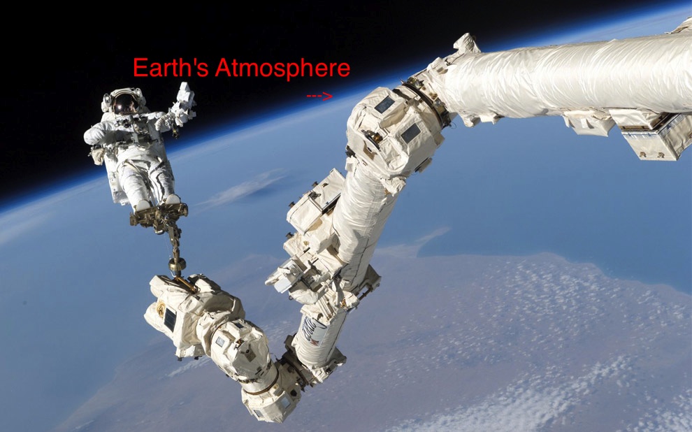
Next, the region just outside of the Core is called the Mantle. In the Mantle you have molten rock called Magma. Magma swirls around in the interior of the Earth and is the driving force behind plate tectonics, earthquakes, tsunamis, and volcanoes. The third layer of the Earth is the Crust. The entire Earth is covered by a dried layer of rock called the Crust. Occasionally Magma will spill through the Crust becoming Lava. Finally, the Earth is surrounded by an Atmosphere. The Atmosphere is an ocean of gas (air) that is made up of a specific recipe which supports life. For example, the 21% of Oxygen in our atmosphere allows animals to breathe and sustain metabolic processes. Too little Oxygen we couldn't breathe, whereas too much Oxygen would become flammable. There are other molecules in the Atmosphere, such as Carbon Dioxide, which supports plant growth.


Tuesday, September 4, 2012

Surface of the Earth

Geographers use differing methods for determining location on the surface of the Earth. By creating maps and names for the different regions on Earth, people are able to use this information to communicate location. There are 7 continents or large landmasses that make up the majority of all exposed land on Earth (1-7 as follows: North America, South America, Antarctica, Europe, Africa, Asia, and Australia).
Aside from the exposed land on Earth, there are also 4 major oceans (1-4 as follows: Pacific, Atlantic, Indian, and Arctic). 


Geographers also use a grid to help determine absolute location. The Geographic Grid is what gives us our ability to accurately track location on Earth via the use of a Global Positioning System (GPS). The Equator is the ) degree Latitude line that is at the widest point perpendicular to the axis of the Earth. Or in other words, the Equator divides the Earth in two halves i.e. North and South. Once the Earth was given latitude lines, cartographers (mapmakers) needed lines to divide the Earth in the other direction to complete the grid. Thus, longitude lines were created to divide the Earth East and West. The 0 degree longitude line is the Prime Meridian that runs North to South through Greenwich, England.